
Autumn hiking in Pennsylvania rewards preparation. Here is a practical route-planning and trail-navigation guide for shorter days, leaf-covered paths and changing conditions.
Navigation begins before the parking lot
An autumn trail can feel familiar on the way in and confusing on the way out. Leaves cover tread, daylight fades earlier, and a small wrong turn at a junction can become a long detour. Good navigation is not limited to carrying a map or downloading an application. It begins with understanding the route, identifying intersections, estimating a conservative turnaround time and telling someone where you plan to travel. In Pennsylvania’s wooded parks and state forests, cell reception may be unreliable. That makes a prepared route plan particularly valuable for short afternoon hikes that seem too simple to require much thought.
Choose a route that fits the day
Match the trail to the least experienced member of your group rather than to the distance you hope to brag about afterward. Look at elevation change, terrain, stream crossings, expected weather and the availability of marked intersections. A short route with steep rocks and wet leaves may take longer than a smooth trail twice as long. Determine whether the route is a loop, an out-and-back or a point-to-point trip requiring a shuttle. Look for trail closure notices on the land manager’s website and do not assume an older online track reflects current conditions. If the route cannot be explained clearly, simplify it.
Use more than one navigation method
A paper map and a compass are useful backups to an offline mapping application. Before departing, download the region for offline use and confirm it opens when the phone has no service. Keep enough battery for unexpected delays, ideally with a small power bank carried in a dry pouch. A phone’s location indicator can be helpful but it does not replace interpreting a trail map. Learn which direction the route travels, where the major junctions lie and what prominent roads or streams surround it. The point is to maintain your bearings before you become uncertain, not to improvise after becoming lost.

Learn the simple landmarks
Take note of the trailhead name, blaze color, nearby parking road and the first major intersection. At each junction, stop and verify the next turn rather than assuming the most worn path is correct. Notice distinct landmarks such as a bridge, large rock outcrop, trail shelter or ridge crossing. On the way back, the same intersection may look completely different from the opposite direction. A quick photograph of the signpost can help as a reference, provided you do not rely on a photograph as your only guidance. Avoid placing cairns or other unauthorized markers that could mislead future hikers or disturb habitat.
Fall leaves change the footing
Fresh leaves can hide roots, loose stones, small holes and slick rock. Wet conditions increase the chance that seemingly firm ground will shift beneath a shoe. Slow down on slopes and test footing before committing your weight to a step. Trekking poles can improve balance for some hikers but cannot make an unsafe crossing safe. Avoid cutting switchbacks, which damages the slope and can increase erosion. When a trail is very muddy, follow the land manager’s advice; sometimes a different route or a postponed hike protects both the environment and the hiker. Keep small children close near drop-offs and streambanks.
Track time, not only miles
Autumn daylight is limited, and shaded wooded terrain often becomes difficult to navigate before the official sunset. Plan the hike with an explicit turnaround time that preserves an extra margin for photos, rest stops and slower travel. Start early enough that the return does not depend on using a flashlight, even though every member of the party should carry a headlamp. If progress is slower than anticipated, shorten the route without treating that decision as failure. Navigation mistakes frequently become more serious when tired hikers rush toward the parking area with little daylight remaining. A turnaround point is a safety decision, not a destination requirement.

Dress for changing conditions
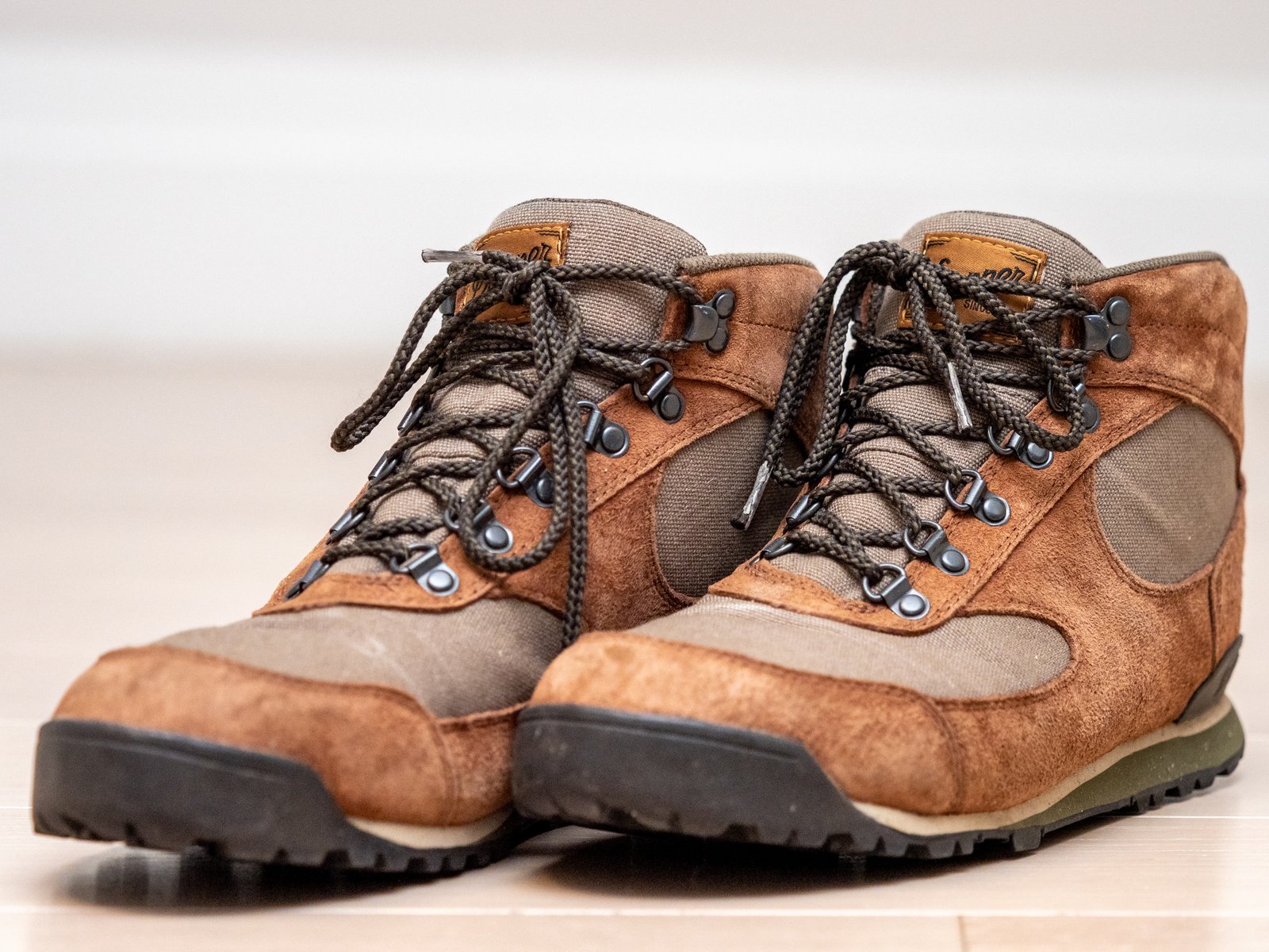
A sunny trailhead can lead to a windy, cold ridge or a damp valley. Carry layers that handle exertion without trapping excessive sweat, and keep an insulating layer protected in a dry bag. A lightweight rain shell can help with wind and unexpected precipitation. Check forecasts for the specific terrain instead of relying only on conditions in the nearest town. Wear footwear you have already tested and carry water even on a short route. Avoid cotton clothing as the primary insulating layer in cold, wet conditions. If the group becomes cold, exhausted or unusually slow, reassess rather than pressing toward the original itinerary.
Tell someone the plan
Give a trusted contact the trail name, parking location, intended route, participants and estimated return time. Agree on when they should become concerned and whom they should contact if no one checks in. A message sent from the trailhead may not go through immediately, so share the plan before arriving. Solo hikers have even more reason to provide a clear itinerary. If plans change substantially, update the contact when service allows. Do not post sensitive live location information publicly; the goal is to ensure a reliable person knows where to begin looking in an emergency.
What to do if you lose the route
Stop moving once you realize the trail or your position is uncertain. Continuing downhill or following an unmarked opening can carry you farther from known ground. Calmly compare your last confirmed junction with the map, compass and any offline location reading. Look for a safe way to retrace steps only if you can identify it confidently. If you cannot determine a safe route, conserve energy, find shelter from weather and seek assistance when possible. In a genuine emergency, call 911 where service is available and explain your location, known landmarks and condition. Moving randomly can make a rescue more difficult.
Keep the essentials accessible
Pack a small kit with water, weather protection, warm layer, first aid basics, headlamp, map, compass and a charged communication device. For remote trips, assess whether a satellite communication option is appropriate. Store frequently needed items where they can be reached without emptying the entire backpack in rain or darkness. Snacks provide a useful energy reserve on a delayed return. Every group member should know where the critical supplies are kept. Equipment is only as useful as the skills behind it, so practice reading the map and using the headlamp close to home before relying on them far from the parking lot.
Respect wildlife and other visitors
Fall overlaps with important seasonal wildlife activity and, in some locations, hunting seasons. Check current land-management guidance and consider high-visibility clothing where appropriate. Keep pets under control and obey leash rules. Do not approach wildlife for photographs or leave food scraps behind. Give uphill hikers room on narrow trails, keep noise at a considerate level and follow posted restrictions. If a section is closed for restoration or safety, choose another path rather than treating the sign as optional. Low-impact travel protects the trail system and reduces the chance that a routine day outdoors becomes a problem for someone else.
Build skill on an easy trail
The best time to learn navigation is on a familiar route with clear markings and an easy exit. Before starting, point out the route on a map and identify north, nearby roads and the planned return. At junctions, ask group members to predict the next turn before reading the sign. After a hike, compare the actual travel time with the plan, noting delays caused by climbing, muddy ground or breaks. This creates a useful personal pace estimate for future trips. If you routinely hike Pennsylvania trails in fall, review the forecast and land manager notices before every outing rather than using last weekend’s conditions.
Finish with a safer habit
A safe autumn hike does not require complicated equipment or an expert-level route. It requires a realistic plan, navigation tools you understand, an appropriate weather margin and a willingness to turn back. Check the route and closure information with Pennsylvania DCNR or the particular park authority, download offline maps, carry a small emergency kit and share your itinerary. Treat an early return as good judgment when the weather, footing or daylight changes. The most rewarding trip is the one that ends with everyone safely back at the trailhead, ready to explore again.
Before going, check official Pennsylvania DCNR hiking information and relevant posted trail or park alerts. This article offers general outdoor preparation suggestions; local conditions determine safe decisions.



0 Comments